
Reasoned Agriculture
Better follow the development cycle of your crops for more targeted, profitable, and reasoned management.
OUR SOLUTION
Pixagri, services for
sustainable agriculture
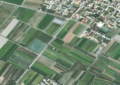
As environmental issues take center stage in our society, agriculture finds itself at the heart of a crucial transformation towards sustainability. In this quest for a more environmentally-friendly agriculture, satellite images emerge as invaluable tools. They offer an unparalleled perspective on agricultural territories, allowing for a precise and real-time assessment of farming practices and their impact on the environment.
Satellite data opens the way to informed decision-making for farmers and decision-makers, enabling them to monitor crop development, water needs and many other key parameters.
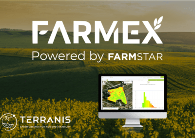
To this end, TerraNIS has developed Pixagri, a range of precision agriculture services designed to support farmers and cooperatives in their agro-ecological transition.

THE DIFFERENT SERVICES
A comprehensive decision-support
tool for managing your crops
Pixagri is a precision agriculture service platform that allows cooperatives and agricultural sector actors to be supported in their agroecological transition.
Irrigation Management
Monitor in real-time the water status of your plots to optimize your irrigation.
Crop Growth
Follow the growth of your crops, detect potential anomalies, and guide your field actions.
Cover Crops
Follow the development of your intermediate covers and estimate the quantities of nitrogen stored and released.
Custom Services
Contact us to discuss your needs and let’s develop a custom offer together.

MOBILE APPLICATION
A solution adapted
for use in the field
Farmers and advisors can now access all Pixagri services directly on their mobile phone, thanks to the new application!
Take your plot data with you wherever you go, and make your work in the field easier by having all your spatialized indicators at your fingertips. Simple and comprehensive, it has been designed to meet your needs in the field and help you make informed decisions while you are out in the field:
- Search for the plots of interest that you are following.
- Access a detailed sheet of the plot with the history of indicators.
- Take geolocated field notes and share them with colleagues.
- Activate an offline mode to use the app in the field without internet access.
Do you want to discover how Pixagri works? Schedule an appointment with our teams for a demo of the tool!
OUR CLIENTS
They trust us,
how about you?


OUR PROJECTS
News from TerraNIS
projects & new developments
A lot is happening at TerraNIS! Discover below the current projects and new features of our services.